<
Back To Index From 2015 Hurricane Season
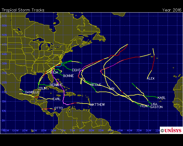
2015 Atlantic Hurricane Season Ended 11/30/2015
2016 Season Begins June 1st
All Charts And Maps Below Are Current
Click
On
STORM NAME
For The Latest Information Available![]()

This Link Takes You To MSNBC's Hurricane TrackerSunday June 19, 2022 08:41:42 -0600
Activity Reference Chart For Atlantic - Caribbean Sea - Gulf of Mexico
Click On 24/7 Time Marked Live Picture At Right To Stream East Into Atlantic Ocean From The Florida Keys
| STATUS | # | NAME | DATE NAMED |
MAX SUSTAINED WIND SPEED (MPH) (LIFE OF STORM) |
MAX FORWARD WIND SPEED (MPH) (LIFE OF STORM) | HURRICANE CATEGORY REACHED | AFFECTED LAND |
| End 5/11 | 1 |
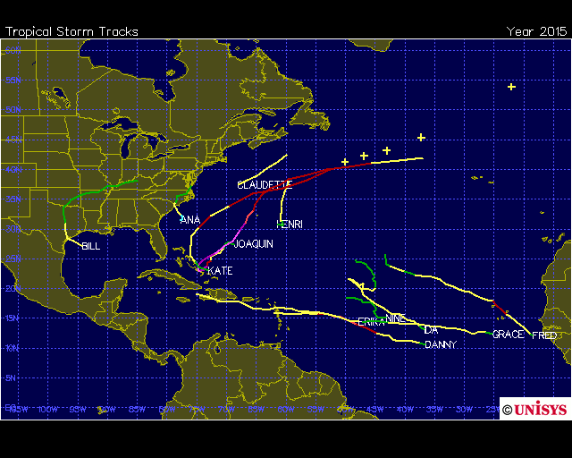
ANA (TS) (First 2015 Storm) Pre-Season |
05/07/2015 | 60 | 5 | South Carolina, North Carolina, Georgia, Virginia | |
| End 6/17 | 2 |
BILL (TS) |
06/15/2015 | 60 | 12 | Texas | |
| End 7/15 | 3 |
CLAUDETTE (TS) |
07/13/2015 | 50 | 21 | None | |
| End 8/24 | 4 | 08/18/2015 | 115 | 14 | 3 | Antilles, Puerto Rico, Dominican Republic | |
| End 8/29 | 5 |
ERIKA (TS) |
08/25/2015 | 50 | 20 | Dominican Republic, Haiti | |
| End 9/6 | 6 | 08/30/2015 | 85 | 16 | 1 | None | |
| End 9/9 | 7 |
GRACE (TS) |
9/5/2015 | 50 | 16 | None | |
| End 9/12 | 8 |
HENRI (TS) |
9/9/2015 | 40 | 16 | None | |
| End 9/27 | 9 |
IDA (TS) |
9/18/2015 | 50 | 12 | None | |
| End 10/8 | 10 | 9/25/2015 | 135 | 21 | 4 | Turks & Caicos, Bahamas, Bermuda | |
| End 11/12 | 11 | 11/9/2015 | 75 | 45 | 1 | Turks & Caicos, Bahamas | |
Storm Notification Provided By Tracking The Eye.Net Non-Colored Storm & Land Names Indicate Forming Storms & Projections
Click Here To Go To World Sunlight Map Click Here To Go To Earth At Night
![]()
![]()
Map Above Courtesy Of: http://www.wunderground.com/

![]()
Click On Map Above To Go To NAVAL ATLANTIC OCEANOGRAPHY CENTER Maps
Map Above Courtesy Of: http://www.AccuWeather.com 3 Hour Max Delay
Click On Map Then Hover Over RED Symbol For Latest NHC Storm Information
Map Above Courtesy Of: National Hurricane Center
2015 Atlantic Hurricane Names
Larry
Mindy
Nicholas
Odette
Peter
Rose
Sam
Teresa
Victor
Wanda
\
Click Here For More Tracking Chart Information

All Hurricane Archive Data Since 1851
![]()
2014 Atlantic Hurricane Season
This Link Takes You To MSNBC's Hurricane Tracker
Activity Reference Chart For Atlantic - Caribbean Sea - Gulf of Mexico
| STATUS | # | NAME | DATE NAMED | MAX SUSTAINED WIND SPEED (MPH) (LIFE OF STORM) | MAX FORWARD WIND SPEED (MPH) (LIFE OF STORM) | HURRICANE CATEGORY REACHED | AFFECTED LAND |
| END 7/5 | 1 |
ARTHUR First Storm / Hurricane 2014 |
07/01/2014 | 100 | 31 | 2 | FL, SC, NC |
| END 8/5 | 2 | 07/31/2014 | 80 | 24 | 1 |
Antilles, Puerto Rico, Haiti. Bahamas |
|
| END 8/29 | 3 | 08/24/2014 | 85 | 46 | 1 |
Lesser Antilles, Puerto Rico, Virgin Islands, Bahamas |
|
| END 9/3 | 4 | 09/01/2014 | 50 | 16 |
Mexico |
||
| END 9/19 | 5 | 09/11/2014 | 115 | 30 | 3 |
Corner Islands |
|
| END 10/13 | 6 | 10/10/2014 | 75 | 29 | 1 |
Bermuda |
|
| END 10/20 | 7 | 10/12/1014 | 145 | 52 | 4 |
Bermuda, Ireland, United Kingdom |
|
| END 10/28 | 8 | 10/27/2014 | 40 | 7 |
Nicaragua |
||
|
Next Storm Name - Isaias |
Storm Notification Provided By Tracking The Eye.Net Non-Colored Storm & Land Names Indicate Forming Storms & Projections
Map Below Courtesy Of: wunderground.com
![]()
Last Page Update: Sunday June 19, 2022 08:41:42 -0600, EDT Imported Charts Updated By Provider, All Current.
